Color infrared layers
We provide color infrared data layers in Lens to help identify certain features or conditions on your property. Unlike Index layers, Color infrared layers display bands from the infrared spectrum of light to visible light bands, rather than quantifying reflectance and calculating an output. Additionally, we don't mask clouds for Color Infrared imagery the way we do for Index layers. These layers are available from both Sentinel-2 (10-meter resolution roughly every 5 days) and Landsat 8 (30-meter resolution roughly every 16 days). For more information on these types of images, we’d recommend reading NASA Earth Observatory's wonderful write-up on falsecolor imagery, another term for color infrared.
This article covers:
- Near-infrared (NIR), red, green
- Blue, short-wave infrared (SWIR)
- Short wave infrared (SWIR), near-infrared (NIR), green
Near-infrared (NIR), red, green
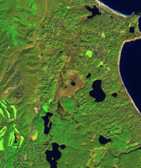
This layer shows near-infrared (NIR) light as red, red light as green, and green light as blue. Plants reflect near-infrared and green light, while absorbing red. Since they reflect more near-infrared than green, plant-covered land appears deep red. Denser plant growth is darker red. Cities and exposed ground are gray or tan, and clear water is black. Similar to NDVI, this band combination is valuable for assessing plant health. Where NDVI is a calculated index, NIR is closer to a raw value.

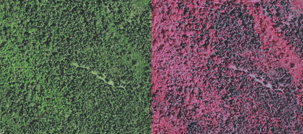
One interesting use for this layer is distinguishing hardwood (deciduous) from softwood (coniferous) trees. The image below shows a mixed stand of hardwood and softwood trees. The left truecolor image displays what the environment naturally looks like to the human eye. While there is clearly some variation in tree types, it is difficult to discern. The right image displays the same forest in Lens’ infrared data layer. We can more easily identify conifers as they appear more grey, while deciduous trees - which have more photosynthetic activity - are bright red.
Blue, short wave infrared (SWIR)
This layer shows blue light as red, and two different short-wave infrared (SWIR) bands as green and blue. This band combination is valuable in distinguishing snow, ice, and clouds. Ice reflects more blue light than snow or clouds. Ice on the ground will be bright red in this color infrared layer, while snow is orange, and clouds range from white to dark peach.
Short wave infrared (SWIR), near-infrared (NIR), green
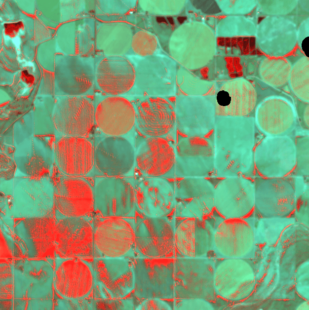
This layer shows near short-wave infrared (SWIR) light as red, NIR as green, and green light as blue. Because water and wet soil stand out in this band combination, it is valuable for monitoring floods. Saturated soil and sediment-laden water will appear blue. Ice clouds, snow, and ice are bright blue, since ice reflects visible light and absorbs infrared. Clear water will show as black. This helps distinguish water from snow and ice; it also distinguishes clouds made up mostly of liquid water or ice crystals.
Newly burned land reflects SWIR light and appears red in this combination. Hot areas like lava flows or fires are also bright red or orange. Exposed, bare earth generally reflects SWIR light and tends to have a red or pink tone. Urban areas are usually silver or purple, depending on the building material and how dense the area is.
Since plants reflect near-infrared light very strongly, vegetated areas are bright green. The signal is so strong that green often dominates the scene.