
Modeled dataset layers
Via the Lens Library, you have access to several modeled datasets that can be added to your account as layers. These are layers derived from remotely sensed images using various methods to classify or quantify for a specific purpose (examples: land use, tree canopy height, etc.). This article will summarize the available modeled dataset layers in Lens. To learn more about the Lens Library, see our article here.
This article covers:
- Biodiversity intactness from Impact Observatory
- Canopy height from Meta and World Resources Institute
- Cheatgrass by USGS
- Cropland data layer by USDA
- ESA Biomass
- Exotic annual grass cover by USGS
- Fractional impervious surface by USGS
- Global forest cover by European Commission JRC
- Global forest loss from Hansen
- Global grassland extent by Land & Carbon Lab
- Grasslands risk by US Fish & Wildlife Service
- gNATSGO soil hydrologic group by USDA and NRCS
- Invasion severity index (CO) by University of Montana and NRCS
- Land cover data from NLCD
- Land cover data from ESA WorldCover
- Land cover data from Space Intelligence
- Land use land cover data from Impact Observatory
- Landcover (Brazil) from MapBiomas
- Landcover (Chaco) from MapBiomas
- Natural lands classification from World Resources Institute
- NatureServe's map of biodiversity importance (MoBI)
- Precipitation by NOAA GEFS from dynamical.org
- Precipitation data from PRISM Climate Group
- Temperature by NOAA GEFS from dynamical.org
- Tree height from CTrees
- Tropical moist forest land cover data by European Commission JRC
Biodiversity Intactness
Created by Impact Observatory and Vizzuality, this data layer depicts the intactness of biodiversity globally for the years 2017-2020 at a 100-meter resolution. The intactness of biodiversity is based both on the abundance of individual species as well the species composition compared to an intact baseline. This dataset can help identify areas of critical remaining intact habitat and help support spatial planning and management. This layer is terrestrial and won't include data for areas of water. Like the MoBI layer, this will load beyond property boundaries so you can see the context of the larger area. Learn more about the methodology in this white paper.

Global Canopy Height by Meta & WRI
The Global Canopy Height dataset provides 1m resolution maps of canopy height, developed using self-supervised learning models trained on aerial imagery and GEDI Lidar. This dataset was created using sub-meter satellite imagery from Vantor between 2009 through 2020, making it a helpful supplement to baselines. This high-resolution data was developed to drive transparency and accountability in carbon markets and conservation efforts. More information can be found in this research paper.

Tree Canopy Height by CTrees

Cheatgrass
The USGS Cheatgrass dataset provides annual fractional percent cover estimates of cheatgrass (Bromus tectorum) across the western United States sagebrush biome at 30m resolution. Estimates are derived from Harmonized Landsat and Sentinel-2 imagery and field observations.

Cropland Data Layer
The Cropland Data Layer (CDL) is produced by the USDA National Agricultural Statistics Service (NASS) using both satellite imagery and ground data. This data layer provides crop-specific land cover classification for the United States annually.

ESA Biomass
ESA's Climate Change Initiative (CCI) Biomass project provides global data on above-ground biomass of woody vegetation for 2007, 2010, and annually from 2015-2022 at a 100m resolution. The global maps are generated from SAR data acquired by ESA's Sentinel-1A and B and JAXA's ALOS PALSAR and ALOS-2 PALSAR-2 satellites. The mapping builds on algorithms developed initially through ESA's GlobBiomass Project, with advancements from ESA CCI Biomass. Algorithms are informed by information on forest height and cover density from spaceborne LIDAR, including NASA's GEDI. For more information about the data, see ESA's CCI Biomass project page.

Exotic Annual Grass Cover
The Exotic Annual Grass (EAG) dataset is developed by USGS and provides weekly percent cover estimates of exotic annual grasses — primarily cheatgrass (Bromus tectorum), medusahead (Taeniatherum caput-medusae), ventenata (Ventenata dubia), and Japanese brome (Bromus japonicus) — in the sagebrush biome of the western United States. This dataset is usually published weekly between April and June. Although this layer includes 16 grass species, cheatgrass was present in 85% of the field sites used to develop the model, making it a proxy of cheatgrass presence in the majority of coverage areas.

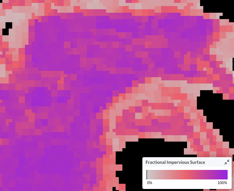
Fractional Impervious Surface
The Annual NLCD Fractional Impervious Surface dataset is developed by USGS and provides the fractional surface area of each pixel that is covered with impervious surfaces such as pavement, concrete, or rooftops. This dataset is created from Landsat data using machine learning and AI and provides annual information for the United States back to 2000.
 Global Forest Cover
 Global Forest Cover
The Global Map of Forest Cover for 2020 V3, developed by the European Commission's Joint Research Centre (JRC), provides a global classification of forest presence and absence at 10-meter resolution. It aligns with the cut-off date of the EU regulation on deforestation-free products (EUDR) and reflects the relevant forest definition of land spanning more than 0.5 hectares with trees higher than 5 meters and a canopy cover of more than 10%, excluding urban, agricultural, and plantation land uses. The map integrates multiple global datasets on land cover, tree height, and land use to produce a detailed, spatially explicit snapshot of global forest cover as of 2020.

Global Forest Loss
The University of Maryland Global Forest Change layer displays 30m data showing gross forest loss for each year from 2001 to 2022, derived from Landsat imagery. Areas where forest has transitioned to non-forest are during a given year are displayed in red on the map. Forest loss could be a result of natural or human-induced causes. This dataset makes it possible to assess the timing and annual extent of forest loss over the last two decades, which can support site assessments and baselining. Data and methodology were originally published by Hansen et. al and this work is a collaboration between the Global Land Analysis & Discovery Lab at the University of Maryland, Google, USGS, and NASA.

Global Grassland Extent by Land & Carbon Lab
Created by the Global Pasture Watch (GPW) research consortium initiated by the Land & Carbon Lab, the global grassland extent maps provide global information delineating cultivated grasslands and natural/semi-natural grasslands at a 30-meter resolution. This dataset is created using a machine learning framework that uses Landsat data, Earth Observation predictor variables, and over 2.3 million reference samples. This data is valuable for tracking changes in grassland ecosystems, informing land-use management, and guiding conservation efforts. For more information, see Land & Carbon Lab's website. OpenLandMap.org hosts this data and had made it accessible for us to pull into Lens.

Grasslands Risk by US Fish & Wildlife Service
The Grasslands Risk Map (v2) is provided by the Central Grasslands Roadmap Initiative and the U.S. Fish & Wildlife Service. It provides a biome-level assessment of the primary drivers of grassland loss — cropland conversion and woody encroachment — categorizing the landscape into core intact grasslands, areas under immediate threat, and areas requiring strategic restoration or reconnection. This layer helps prioritize conservation actions where they will be most effective.

gNATSGO Soil Hydrologic Group
The gridded National Soil Survey Geographic Database (gNATSGO) is a comprehensive dataset that combines the Soil Survey Geographic Database (SSURGO), State Soil Geographic Database (STATSGO2), and Raster Soil Survey Databases (RSS) into a single, gridded dataset. It is maintained by the United States Department of Agriculture (USDA) and Natural Resources Conservation Service (NRCS). It provides detailed information about soil properties and classifications across the United States.
-
Group A - Group A soils consist of deep, well drained sands or gravelly sands with high infiltration and low runoff rates.
-
Group B - Group B soils consist of deep well drained soils with a moderately fine to moderately coarse texture and a moderate rate of infiltration and runoff.
-
Group C - Group C consists of soils with a layer that impedes the downward movement of water or fine textured soils and a slow rate of infiltration.
-
Group D - Group D consists of soils with a very slow infiltration rate and high runoff potential. This group is composed of clays that have a high shrink-swell potential, soils with a high water table, soils that have a clay pan or clay layer at or near the surface, and soils that are shallow over nearly impervious material.
-
Group A/D - Group A/D soils naturally have a very slow infiltration rate due to a high water table but will have high infiltration and low runoff rates if drained.
-
Group B/D - Group B/D soils naturally have a very slow infiltration rate due to a high water table but will have a moderate rate of infiltration and runoff if drained.
-
Group C/D - Group C/D soils naturally have a very slow infiltration rate due to a high water table but will have a slow rate of infiltration if drained.

Invasion severity index from University of Montana and NRCS
License: Public domain

Landcover data from NLCD
This layer shows the National Land Cover Database (NLCD) classifications of land cover at 30m resolution based on a 16-class legend. The NLCD is developed by a partnership of multiple United States Federal agencies and the most recent available layer in Lens is from 2000. You can visualize this public dataset and landcover classifications for properties in Lens but Upstream Tech is not responsible for the accuracy of the classifications. The legend for this layer will appear on your screen when the layer is selected.

Landcover Data from ESA WorldCover
The ESA WorldCover global landcover layer from 2020 is based on data from Sentinel-1 and 2, and provides land cover classifications at 10m resolution globally. This data layer from the European Space Agency was developed by a consortium major European service providers and research organizations and includes 12 categories of land cover. You can visualize this public dataset and landcover classifications for properties in Lens but Upstream Tech is not responsible for the accuracy of the classifications. The legend for this layer will appear on your screen when the layer is selected.

Land Cover Data from Space Intelligence
This land cover dataset from Space Intelligence maps habitat types for available countries with 10m spatial resolution. These audit-grade maps are suitable for use in a wide variety of critical applications. Built using a proprietary geospatial data analytics model (HabitatMapperTM), Space Intelligence’s data enables project developers and investors to inform and validate forest carbon project baselines. The data is locally calibrated and captures regional factors such as national forest definitions, seasonality of forests, and cloud cover that impact land cover classification and change detection for enhanced precision allowing users to screen areas, review project activity, and perform due diligence on nature-based projects. Learn more information from the full support article here or fill out this form to request this data.

Impact Observatory's Land Use Land Cover
This dataset, produced by Impact Observatory, Microsoft, and Esri, displays a global map of land use/land cover (LULC) derived from ESA Sentinel-2 imagery at 10m resolution for 2017 - 2022. Each year is generated from Impact Observatory’s deep learning AI land classification model using a massive training dataset of billions of human-labeled image pixels. The global maps were produced by applying this model to every Sentinel-2 scene, processing over 400,000 Earth observations per year. The algorithm generates LULC predictions for 9 classes globally. These classifications include Built, Crops, Trees, Water, Rangeland, Flooded Vegetation, Snow/Ice, Bare Ground, and Clouds. Additional information about Impact Observatory's global maps is available here and you can reach out to their team directly with any questions about the data and methodology. The legend for this layer will appear on your screen when the layer is selected.

Custom land cover data from Impact Observatory
In addition to the free Impact Observatory Landcover dataset, we also offer a premium version with more classifications and recent data. Impact Observatory's innovative AI-powered methods categorize land cover into 14 classes: Water Channel Extent, Variable Water, Persistent Water, Dense Trees, Sparse Trees, Dense Rangeland, Sparse Rangeland, Flooded Vegetation, Crops, High Density Built, Low Density Built, Bare Ground, Snow/Ice, Clouds. This custom data can be requested directly through Lens and costs $.02/acre, with a minimum spend of $500. The data will include the time period requested and one year prior for baseline comparison. To initiate a data request, click the "Request" button on the Custom Landcover tile in the Layers Library and fill out the linked form to get a quote for your area and time frame.

Landcover (Brazil)
The MapBiomas Brasil dataset provides annual land use and land cover maps for Brazil from 2000 to 2022, created through a collaboration between NGOs, universities and technology companies. This dataset includes dozens of land cover categories and offers a comprehensive view of how Brazil's landscapes have transformed over time, making it an essential resource for monitoring environmental changes. The project is continually updated to improve accuracy and coverage. Detailed accuracy information and methodological insights are available here.

Landcover (Chaco)
The MapBiomas Chaco dataset offers annual land cover and land use maps for the Gran Chaco Americano, covering Argentina, Bolivia, Brazil, and Paraguay from 2000 to 2022. This initiative is a collaborative effort involving local experts in land use, satellite remote sensing, and GIS to understand the dynamic changes in this unique region. Using advanced cloud processing and automated classifiers on the Google Earth Engine platform, the project provides an open, accessible, and updated resource for monitoring environmental transformations in the Gran Chaco. More information about this dataset can be found here.

Natural Lands Classification (WRI)
The WRI Natural Lands Classification layer, part of the Science Based Targets Network (SBTN), provides a comprehensive global map of natural lands as of 2020, designed to support companies in setting "no conversion of natural ecosystems" targets. Developed by WRI's Land & Carbon Lab in collaboration with the World Wildlife Fund and Systemiq, this dataset combines the best available global and local geospatial data to establish a common baseline for visualizing natural land extent. The map helps companies assess their responsibility for land conversion post-2020 and make informed decisions about their operations and supply chains. See technical documentation here for more detail.

NatureServe's Map of Biodiversity Importance (MoBI)
The Map of Biodiversity Importance (MoBI) Layer provides information about the number of species in the continental US that are protected by the Endangered Species Act and/or considered to be in danger of extinction. This dataset is free and available to all Lens customers, and will be displayed beyond the property boundaries to enable you to contextualize your site within a larger area. The MoBI layer visualizes NatureServe's All Species Richness dataset which covers the continental United States - it's useful to understand the richness of species including vertebrates, freshwater invertebrates, pollinators, and plants. The richness value represents the number of species with habitat overlapping a given 990 meter cell. As a synthesis of predictive models, MoBI cannot guarantee either the presence or absence of imperiled species at a given location.
NatureServe has been an authoritative source for biodiversity data over many decades, collecting, analyzing, and delivering biodiversity knowledge that informs conservation action. To learn more about their MoBI dataset, see here.

Precipitation from NOAA by dynamical.org
Learn more about the GEFS analysis dataset here.

Precipitation Data from PRISM Climate Group
This data layer is available for Standard and Enterprise customers.
Monthly precipitation data from the PRISM Climate Group at Oregon State University offers insights into monthly patterns across the United States from 2010-present. The PRISM data uses a weighted regression scheme to account for complex climate regimes associated with orography, rain shadows, temperature inversions, slope aspect, coastal proximity, and other factors. By assimilating station data from various networks nationwide, PRISM provides a detailed understanding of precipitation which can be used to contextualize other Lens datasets, identify risks such as drought conditions, and support water resource management decisions. Learn more about PRISM datasets here.

Temperature by NOAA from dynamical.org
Learn more about the GEFS analysis dataset here.

Tropical Moist Forest Landcover
The annual change collection dataset, developed by the European Commission’s Joint Research Centre (JRC), provides annual classifications of tropical moist forest (TMF) land cover from 1990 to 2023, available in tropical forest regions only. It classifies the forest into six categories: intact/undisturbed, degraded, deforested, regrowing, water, and other. The dataset is a valuable tool for tracking changes in tropical forest conditions and monitoring changes such as deforestation, forest degradation, and regrowth over time. See here for more information.
