
Parcel data overlay
We’re happy to provide the Parcel Data Overlay feature for customers in the Standard and Enterprise plans.
Overview
Regrid is an industry-leading property data and location intelligence company which provides land parcel data across the United States. Regrid’s nationwide land parcel dataset covers over 151 million parcels and is constantly updated to ensure that the information you see in Lens is up-to-date.
How to view parcel data
From the property map view, click the overlays button on the right toolbar and select “Parcel Data” to view the parcel boundary lines in blue. Hover on any parcel and you’ll see more detail, including the parcel owner, parcel ID, and address.

Customizing how you view the Parcel Data overlay
Because this is an overlay, you can view it on top of other imagery layers and customize your colors by clicking on the color of the overlay polygon, as shown below. To view the parcel boundaries without fill once you’re zoomed into your property, you can hold down the option/alt key. You can control whether the parcel overlay is filled or appears as no-fill outlines by default by clicking the settings button on the overlay, as shown below.

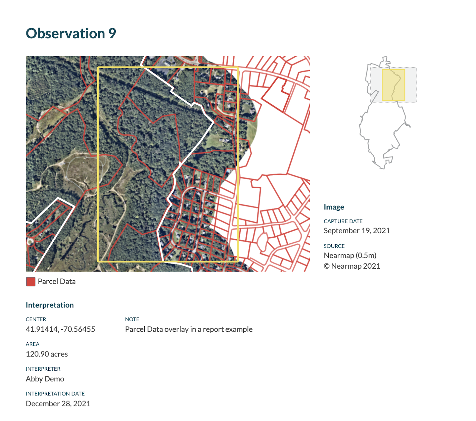
Viewing the parcel data overlay in reports
If you would like to see parcel boundaries in your report, generate a report and navigate to the relevant page and click on the edit icon in the top left of the image. This will show several options for customizing the image, including the overlays icon where you can check or uncheck the overlays you’d like to see on this page, including parcel data. Exporting a report with the parcel data overlay enabled, or generating a Parcel Owner Report is the best way to export it from Lens, as exporting or downloading parcel geometries is restricted in our license with Regrid.
Frequency of updates
Regrid updates parcel data about every two weeks as new information becomes available, but may depend on when counties release updated data. We are always streaming the most up-to-date information from Regrid on the parcel data overlay. You can check to see when your area's information was last updated on this spreadsheet from Regrid.
Parcel owner alerts
Check out this article on our parcel owner alerts feature, which will notify you on a quarterly basis if a tax parcel of an enrolled property changes hands. This tool serves as a second set of eyes to help you identify potential subdivisions or when ownership information might need to be updated.