
Downloading imagery from Lens
We offer a few ways to download imagery you’ve ordered through Lens for record-keeping purposes or use in other geospatial software.
- Downloading PNG files
- Downloading GIFs from compare mode
- Downloading GeoTIFF files
- Downloading geospatial PDF files
- Reminder on imagery use and licensing
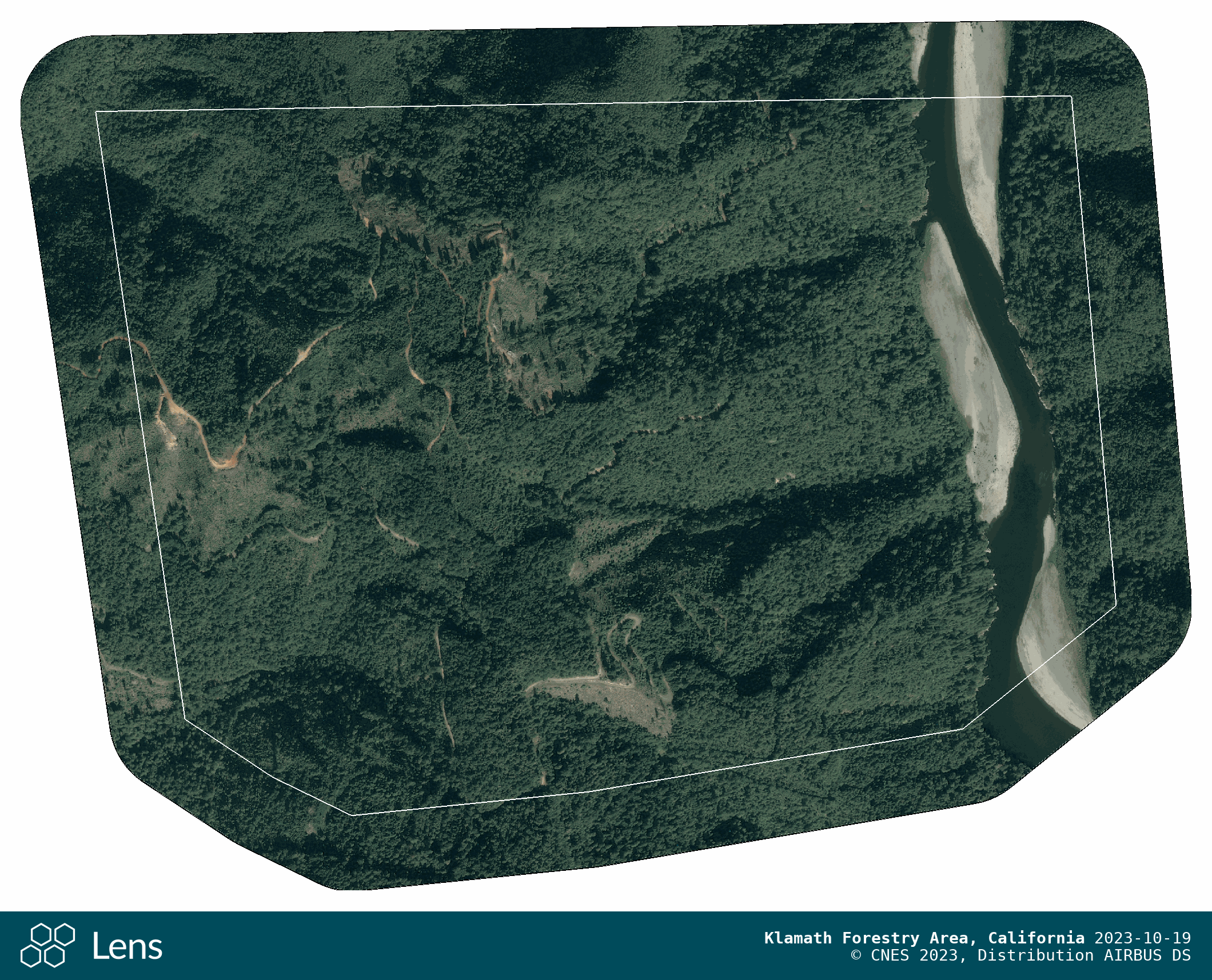
If you’re looking at an image of your property in the map view, navigate to the Details pane on the left and scroll down to see available formats for the image you’ve selected.

Downloading PNG files
You can download PNG exports for any image in Lens (including the high frequency and ecological layers). PNGs are exported at a reduced resolution and are not georeferenced. Exports are designed to adhere to vendor requirements of maximum width/height resolution as well as the required attribution.
The PNG file includes a single property, including property boundary, imagery source and capture time for the selected layer. These maps can be a great resource to share with landowners or other stakeholders to showcase the state of a property at any given time.

Organizations with Enterprise subscription plans can request a bulk download of PNGs for images ordered in Lens as-needed by emailing us at lens@upstream.tech, and will receive a temporary link to download the files.
Downloading GIFs from compare mode
While in compare mode, you can download a GIF that flickers between the two images you've selected. The downloaded GIF will include metadata about each image, and is a handy way to download a comparison of two images. Downloading GIFs works for any layers (Truecolor, vegetation, NIR, etc) as long as you're in compare mode.
Downloading GeoTIFF files
GeoTIFFs are an industry-standard type of raster image file commonly used to store satellite and aerial imagery data, which has the georeferencing information embedded within the file. GeoTIFFs are compatible with nearly all GIS applications, including Esri’s ArcGIS or QGIS, and maintain their quality when compressed, edited, or transferred.
GeoTIFFs can be individually downloaded from the Details pane from a property page in Lens. Please check our Lens Imagery & Data Overview article for the most up to date information about which data can be downloaded in the GeoTIFF format.
Organizations with Enterprise subscription plans can request a bulk download of GeoTIFFs for Airbus images ordered in Lens as-needed by emailing us at lens@upstream.tech, and will receive a temporary link to download the files.
Viewing Lens GeoTIFFs in ArcMap, ArcPro, and QGIS
This section covers how to load the GeoTIFF files in your geospatial software. Note that the placement or wording of these options may vary slightly depending on which version you are using.
Viewing a downloaded image in ESRI ArcGIS
In ArcMap and ArcGIS Pro, navigate to Add Data, where you can select the .tif file

If you are using ArcGIS Online, you can upload the .tif file to your My Content page by selecting new item. This allows the file to be shared with others for download, but the file cannot be added directly to a web map. To do this, you would need to either convert the raster data to KML or publish the GeoTIFF file as a tile service to ArcGIS Online. See this article for more detail.
Viewing a downloaded image in QGIS
If you’re using QGIS, you should be able to drag and drop the image and QGIS will automatically recognize the image and take you to this location on the map. Attribution details can also be found in Layer properties.
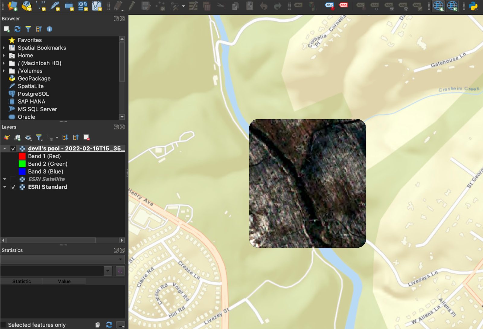
Alternatively, you can also add the .tif file using the Add Data tool or by adding a Raster Layer, as shown below.

Downloading geospatial PDFs
Geospatial PDFs are georeferenced PDFs, exported at a reduced resolution, that can be used in PDF viewers and some GIS applications. This download option is available for any sources that allow a GeoTIFF download.

Reminder on imagery use and licensing
Please be sure to review the Commercial Imagery Use FAQ to understand the respective imagery vendor's permitted uses for these image downloads. Images downloaded from Lens can be used for internal purposes at your organization.